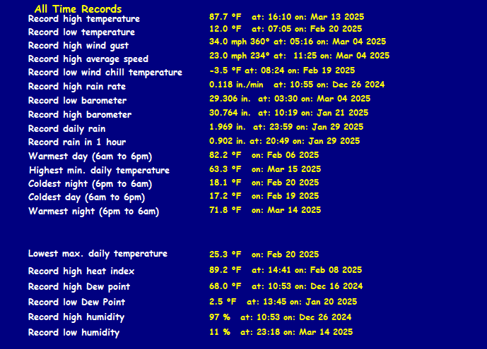
TXZ118
Current watches, warnings, and advisories for Tarrant (TXZ118) TX
| Weather Data | |||
|---|---|---|---|
| LAST READING AT TIME: 00:30 DATE: April 02 2026, time of next update: 00:35 | |||
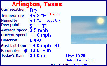
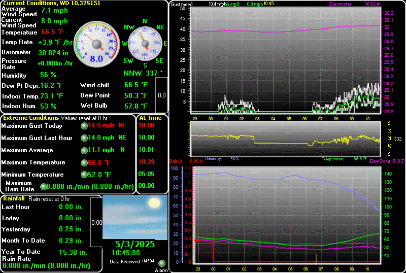
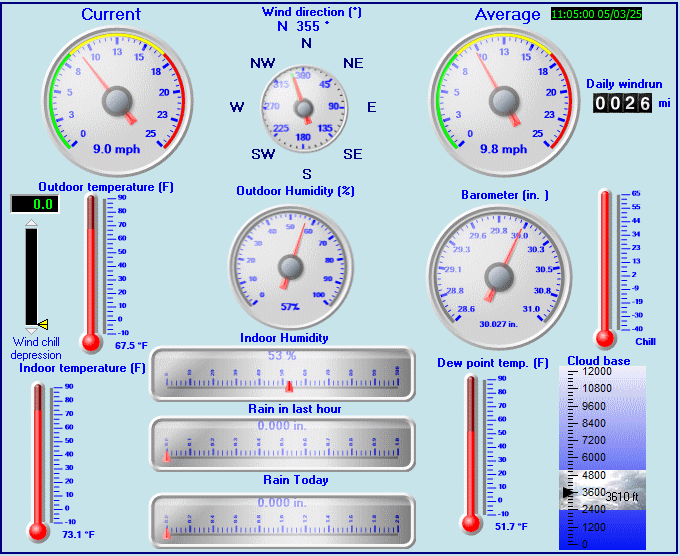
| Current Weather | Night time/Dry | Current Temperature | 74.4°F (23.6°C) (Heat Index 74.4°F ), Apparent temp 74.4°F |
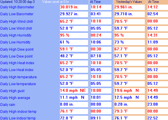
| Maximum Temperature (since midnight) | 75.2°F at: 00:00 | Minimum Temperature (since midnight) | 74.4°F at: 00:26 |
| Average windspeed (ten minute) | 7.5 mph | Wind Direction (ten minute) | SSE (166°) |
| Windchill Temperature | 74.4°F | Maximum Gust (last hour) | 25.0 mph at: 00:24 |
| Maximum Gust (since midnight) | 25.3 mph at: 00:24 | Maximum 1 minute average (since midnight) | 11.4 mph at: 00:25 |
| Rainfall (last hour) | 0.00 in. (0.0 mm) | Rainfall (since midnight) | 0.00 in. (0.0 mm) --- |
| Rainfall This month | 0.00 in. (0.0 mm) | Rainfall To date this year | 5.05 in. (128.3 mm) |
| Maximum rain per minute (last hour) | 0.00 in/min | Maximum rain per hour (last 6 hours) | 0.00 in/hour |
| Yesterdays rainfall | 0.00 in | DewPoint | 61.0°F (Wet Bulb :66.2°F ) |
| Humidity | 63 %, Humidex 82.8°F | Barometer corrected to msl | 29.659 in. (1004.4 hPa) |
| Pressure change | +0.00 in. (last hour) | Trend (last hour) | STEADY |
| Pressure change (last 12 hours) | -0.17 in | Pressure change (last 6 hours) | +0.01 in |
| Current Indoor Temp. 82.7°F | |||
| Current Indoor Hum. 48% | |||
Use the RELOAD facility on your browser to retrieve the latest data.